
Information is fragmented
Asset records, sensor data, documents and local knowledge sit across different systems and teams.
Understand operations through the places where they happen. Helios connects your physical environment with the information needed to understand and manage it.
Built to Simplify, Designed to Scale
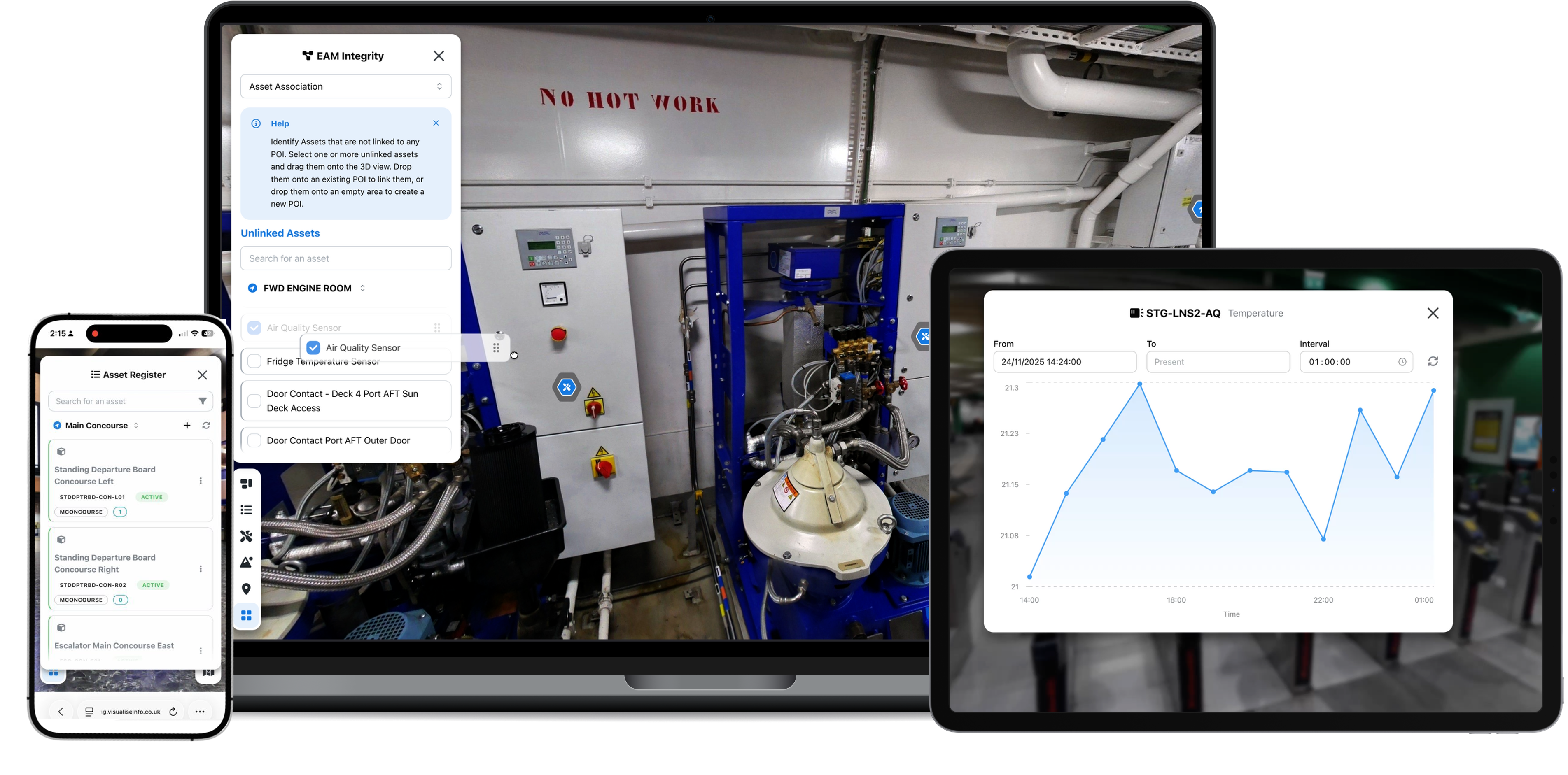
Enterprise information is often divided across specialist systems, documents and physical locations. Understanding an asset, issue or activity can mean manually reconstructing the picture before work can begin.
Asset records, sensor data, documents and local knowledge sit across different systems and teams.
People compare records, images and conversations to understand what something is and where it belongs.
When the remote view is incomplete, a site visit may be needed simply to understand the situation.
Helios uses the physical environment to make information from specialist systems easier for people to find, understand and use.
Connects
Enables people to
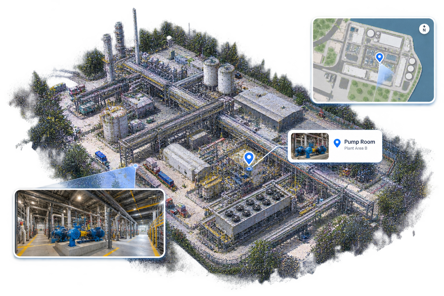
Helios creates a faithful, navigable model of the physical site, giving teams a shared reference for where things are, how spaces relate, and what surrounds any asset or issue.
Point clouds, panoramic imagery, maps and spatial points of interest can form the navigable 3D environment commonly described as a digital twin. Helios extends that spatial foundation by connecting operational information and workflows directly to the places they describe.
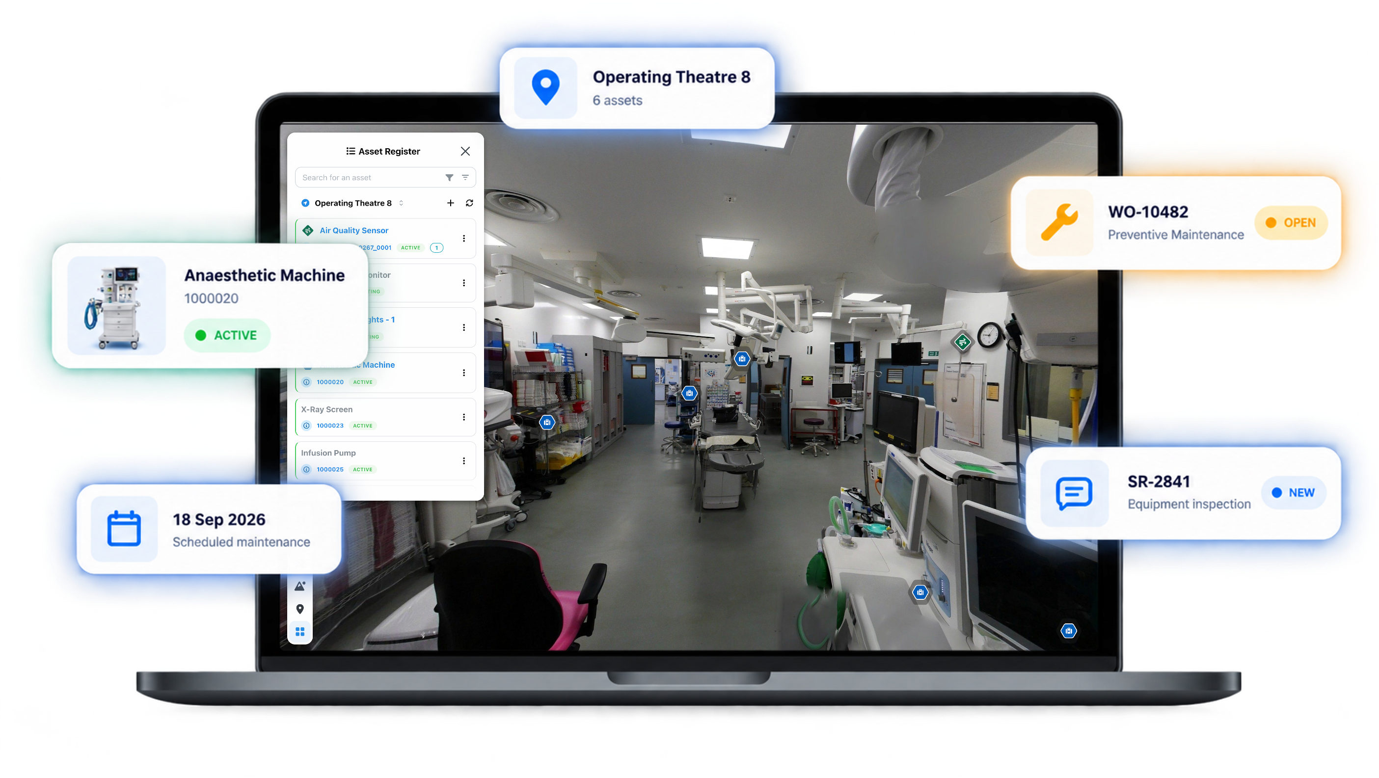
Start with an asset, location or issue in the environment, then reach the records and activity connected to it. Teams can understand operational information without repeatedly reconstructing the same picture across separate systems.
Sensor data starts in external sensors, building systems and other source platforms. Configured integrations, including IoTHub where appropriate, bring relevant readings into Helios so teams can review them against the asset or location they describe.
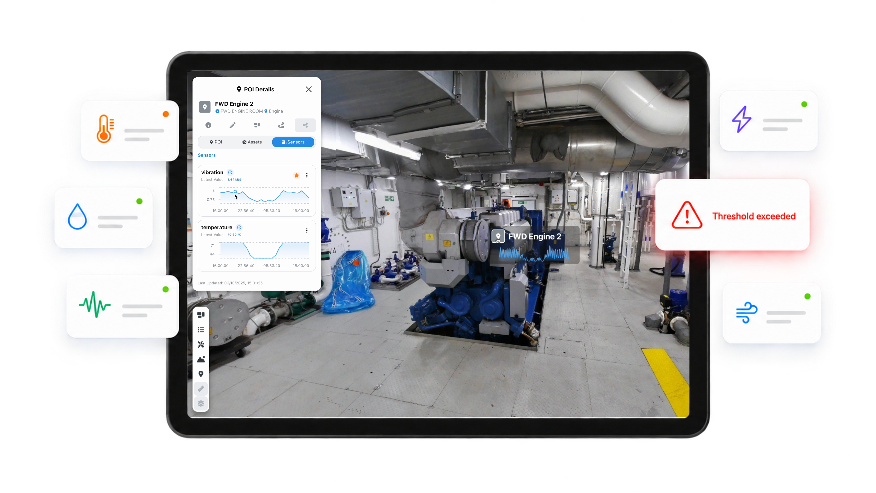
Readings originate in sensor networks, building systems and other operational sources.
Configured integrations bring the information needed for each Helios environment into view.
See current and historical values against the relevant asset or location.
Review changing sensor conditions alongside current and historical readings in their asset or location context.
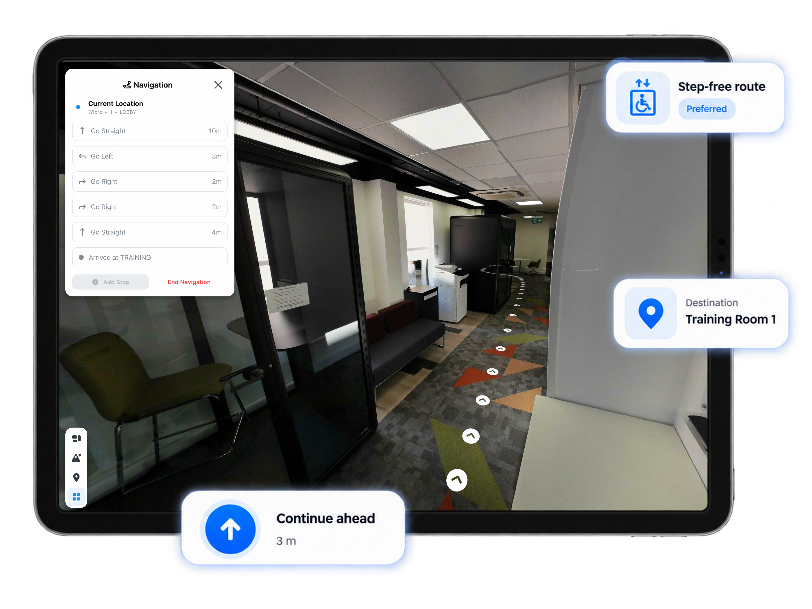
Plan a route through an unfamiliar or complex environment, organise multiple stops and follow map and written guidance while moving between them.
Route preferences can account for features such as stairs, lifts and ramps where navigation data has been configured. Available routes depend on the environment and its surveyed information.
Organise several destinations into one journey rather than navigating to each location separately.
Use configured route preferences to account for features such as stairs, lifts and ramps.
Follow routes through the same environment used to explore assets, points of interest and operational information.
Open the documents, media and supporting information relevant to a place without losing sight of the environment they describe.
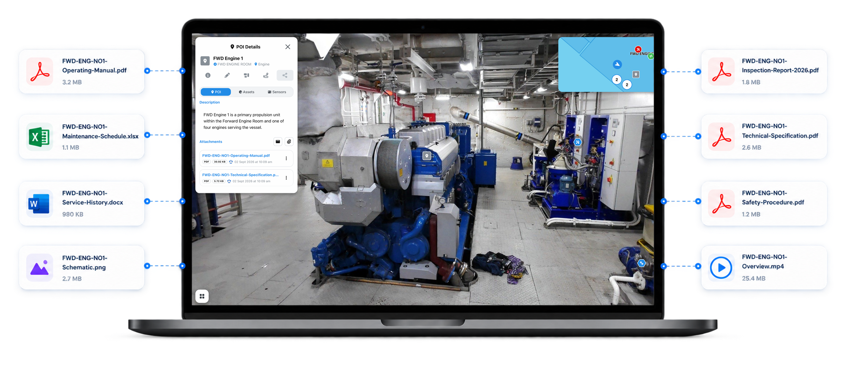
Spatial points of interest give information a clear location within the environment.
Reach files, links, attachments and media from the place they relate to.
Bring operational and location-aware details into the same view.
Use InfoHub to organise sensor data, content and information for a specific need.
Embedding intelligence where decisions happen, at the intersection of data, assets and people.
Helios is evolving beyond monitoring and simple automation to help teams recognise meaningful changes in operational conditions, reduce noise and connect the events that matter to an appropriate response.
Recognise sensor conditions that require attention and connect them to an appropriate operational response.
Reduce noise during periods of high sensor activity and surface the events that require attention.
Bring sensor events together with asset and spatial context so teams can understand what is happening, where it is happening and what needs attention.
Start with the environment, bring the relevant information into view and keep a shared understanding as work moves between office, site and specialist teams.
Locate spaces, assets, records and supporting information through where they are.
See an issue alongside its surroundings, related information and operational history.
Review registered information beside visual evidence so discrepancies are easier to identify.
Bring instructions, reporting and location information together for planning and field activity.
Give teams a shared visual reference and reduce site visits when remote review is sufficient.
The same spatial foundation can support different teams and stages of work. These are applications of the shared Helios platform, shaped around the environment and information each workflow needs.
Helios includes accessibility settings that let users adjust how the interface and spatial information are presented, helping the same environment work for a wider range of needs and preferences.
Increase interface sizing and other display elements to make controls and information easier to use.
Use high-contrast or desaturated presentation options to improve visual clarity.
Adjust how points of interest are presented, including larger markers and persistent information where appropriate.
Familiar spatial interactions help people reach relevant information, while administration and permissions keep access aligned with each organisation.
Choose the deployment approach that fits your organisation.
Deploy Helios through Visualise Info's managed cloud environment.
Use an on-premises deployment where organisational requirements call for it.
Spatial capture support
Visualise Info supply first-class LiDAR scanning where spatial capture is required.
Practical answers about integration, deployment and how Helios works alongside existing enterprise systems.
Tell us about your environment and the workflows you want to bring together. We will arrange the right way to demonstrate Helios.
Request a demo